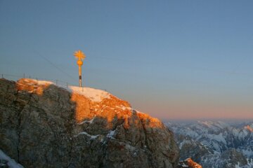
ZUGSPITZ-3
Start: valley station Ehrwalder Almbahn
End: Sonn-Alpin, Zugspitzplatt
Directions:
The starting point of the hike is the valley station of the Ehrwalder Almbahn (alternatively use the mountain railway). From there, follow the Wiesenweg on the right, past the BrentAlm. Past the Ganghofer Hütte (closed in summer), Ehrwalder Alm and the Tirolerhaus and further towards Pestkapelle. Through the forest on the Max-Klotz-Steig, past the Hochfeldern Alm and on to the first yoke. From there, follow the gently falling path to the Felddernjöchl. Past the junction "Steinernes Hüttel", first falling in a north-easterly direction and then rising steeply to the Gatterl. Continue on the Plattsteig to the Knorrhütte, over the scree and the snow fields in a northeasterly direction to the Zugspitzplatt. From there continue on marked and secured path to the Zugspitz summit (2,962m). Valley descent with the Tyrolean Zugspitzbahn. This tour is only recommended for experienced, sure-footed and vertigo-free hikers.
Facts:
- Difficulty: black paths (difficult!)
- Length: 15,5 km
- Uphill: 1.979 m
- Duration: 9h
- Path: Gravel, trails, forest, rocky trails
- Best Season: Summer, autumn
- Recommended Equipment: Appropriate clothing, sturdy shoes, rain protection, sun protection, hiking poles, sufficient fluid. No climbing equipment required.
Important notes:
- Stay on the marked hiking trails
- Keep your distance from grazing animals
- Note the opening times of the huts
- Alpine emergency call: 140
- Good physical condition, sure-footedness and a head for heights are required
Alternativ:
- Ascent with the Ehrwalder Almbahn
- Ascent from the Sonn-Alpin via the via ferrata to the Zugspitze
Tipp:
- Gatterlticket
Start: Grainauer Kurhaus
End: Grainauer Kurhaus
Directions:
The hike starts at the Kurhaus in Grainau, leads over the Christlhütte and the Zierwald and on towards Eibsee. From there take the Zugspitze cable car to the Zugspitze and up to the summit (2,962m). The Tyrolean Zugspitzbahn takes you back down to the valley, and from there to the Hochthörle hut and back over the Thörlen to the Eibsee and Grainau.
Facts:
- Difficulty: moderate
- Length: 14,3 km
- Uphill: 707 m
- Duration: 5 hours
- Path: Partly climbs, partly scree, meadow hiking trails
- Beste Jahreszeit: Summer, autumn
- Recommended Equipment Appropriate clothing, sturdy shoes, rain protection, sun protection, hiking poles, sufficient liquid. No climbing equipment required.
Important notes:
- Stay on the marked hiking trails
- Keep your distance from grazing animals
- Note the opening times of the huts
- Alpine emergency call: 140
- Good physical condition, sure-footedness and a head for heights are required
Start: Tourist-Information Garmisch, Richard-Strauss-Platz
End: beliebig
Directions:
The starting point is the Garmisch tourist information office on Richard-Strauss-Platz, across Garmisch it goes over the Loisach in the direction of Maximilianshöhe and on over the Kramerplateauweg and Höhenrain to the neighboring town of Grainau and the Eibsee. From there take the Zugspitz cable car to the Zugspitze, with a short detour to the Zugspitzgifpel (2,962m). The Tyrolean Zugspitzbahn takes you back to Tyrol (Ehrwald), and from there back to the guest bus Bayern-TirolGarmisch-Partenkirchen.
Facts:
- Difficulty: easy
- Length: 16,0 km
- Uphill: 404 m
- Duration: 6 h
- Path: Well-maintained hiking trails, cleared in winter
- best season: the whole year
- Recommended Equipment: Appropriate clothing, sturdy shoes, rain protection, sun protection, hiking poles, sufficient fluid.
Important notes:
- Stay on the marked hiking trails
- Keep your distance from grazing animals
- Note the opening times of the huts
- Alpine emergency call: 140
- Good physical condition, sure-footedness and a head for heights are required


